Google Earth
Overview
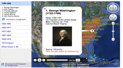
Google Earth is a geo-mapping tool that makes use of a wide variety of imaging sources. It combines satellite imagery and aerial photography to create interactive maps accessible via free desktop download. The tool’s primary educational value lies in enabling students and teachers to manipulate geographic data and construct custom visuals that enhance historical learning. The platform includes a “Showcase” section where educators can explore curated collections focused on topics like “U.S. Presidents” and “Historical Imagery.”
Getting Started
Installation is the first step—teachers should consult their school’s Instructional Technology specialist before installing on school computers. Google provides built-in tutorials for each feature.
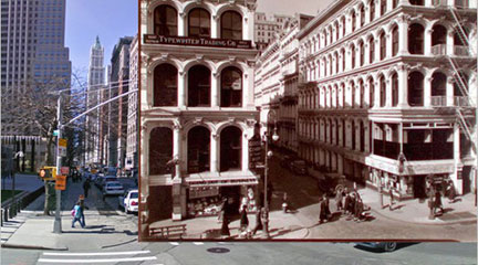
The Historical Imagery tool is an ideal starting point. The feature allows users to examine how locations change over time. For instance, satellite images of Washington DC dating to 1948 show Smithsonian growth, while 60 years of Las Vegas imagery reveals urban expansion patterns relevant to migration and 20th-century history. The Layers function provides access to 10 categories including borders, photos, roads, 3D buildings, and gallery content from National Geographic, NASA, and the New York Times.
Example
Elementary activities include map projects like “Flat Stanley” adaptations or scavenger hunts where students create placemarks and pathways. A 5th grade lesson on “Slavery, Exploitation, and Slave Trade Routes” guides students in creating interactive maps with placemarks for Atlantic trade locations, ship routes, and layered historical images.